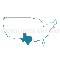
Alamo Area COG (Northeast)--Guadalupe County PUMA, Texas
About
Outline
--Guadalupe+County+PUMA%2c+Texas_A280.png)
Summary
| Unique Area Identifier | 194142 |
| Name | Alamo Area COG (Northeast)--Guadalupe County PUMA |
| State | Texas |
| Area (square miles) | 714.81 |
| Land Area (square miles) | 711.30 |
| Water Area (square miles) | 3.52 |
| % of Land Area | 99.51 |
| % of Water Area | 0.49 |
| Latitude of the Internal Point | 29.58320810 |
| Longtitude of the Internal Point | -97.94902680 |
Maps
Graphs
Select a template below for downloading or customizing gragh for Alamo Area COG (Northeast)--Guadalupe County PUMA, Texas
--Guadalupe+County+PUMA%2c+Texas_T0.png)
--Guadalupe+County+PUMA%2c+Texas_T1.png)
--Guadalupe+County+PUMA%2c+Texas_T2.png)
--Guadalupe+County+PUMA%2c+Texas_T3.png)
--Guadalupe+County+PUMA%2c+Texas_T4.png)
--Guadalupe+County+PUMA%2c+Texas_T5.png)
--Guadalupe+County+PUMA%2c+Texas_T6.png)
--Guadalupe+County+PUMA%2c+Texas_T7.png)
Neighbors
Neighoring Public Use Microdata Area (by Name) Neighboring Public Use Microdata Area on the Map
- Alamo Area COG (Northeast)--Comal County PUMA, TX
- Bexar County (Northeast)--San Antonio (Northeast), Universal City & Converse Cities PUMA, TX
- Bexar County (South)--San Antonio City (Far South) PUMA, TX
- Capital Area COG (East)--Bastrop, Caldwell, Fayette & Lee Counties PUMA, TX
- Capital Area COG (Southwest)--Hays County PUMA, TX
- Golden Crescent Regional Planning Commission (North) & Wilson & Karnes Counties PUMA, TX
Top 10 Neighboring County (by Population) Neighboring County on the Map
- Bexar County, TX (1,714,773)
- Hays County, TX (157,107)
- Guadalupe County, TX (131,533)
- Comal County, TX (108,472)
- Wilson County, TX (42,918)
- Caldwell County, TX (38,066)
- Gonzales County, TX (19,807)
Top 10 Neighboring County Subdivision (by Population) Neighboring County Subdivision on the Map
- San Antonio Northeast CCD, Bexar County, TX (233,237)
- Schertz-Cibolo CCD, Guadalupe County, TX (69,576)
- New Braunfels CCD, Comal County, TX (63,736)
- San Marcos CCD, Hays County, TX (55,314)
- Seguin CCD, Guadalupe County, TX (40,992)
- San Antonio East CCD, Bexar County, TX (32,691)
- La Vernia CCD, Wilson County, TX (11,032)
- Northeast Guadalupe CCD, Guadalupe County, TX (9,186)
- Luling CCD, Caldwell County, TX (8,016)
- Southwest Guadalupe CCD, Guadalupe County, TX (7,859)
Top 10 Neighboring Place (by Population) Neighboring Place on the Map
- New Braunfels city, TX (57,740)
- San Marcos city, TX (44,894)
- Schertz city, TX (31,465)
- Seguin city, TX (25,175)
- Universal City city, TX (18,530)
- Cibolo city, TX (15,349)
- Selma city, TX (5,540)
- Luling city, TX (5,411)
- Redwood CDP, TX (4,338)
- McQueeney CDP, TX (2,545)
Top 10 Neighboring Unified School District (by Population) Neighboring Unified School District on the Map
- Judson Independent School District, TX (113,801)
- Comal Independent School District, TX (99,194)
- San Marcos Consolidated Independent School District, TX (64,257)
- Schertz-Cibolo-Universal City Independent School District, TX (58,437)
- East Central Independent School District, TX (45,223)
- New Braunfels Independent School District, TX (44,455)
- Seguin Independent School District, TX (42,952)
- La Vernia Independent School District, TX (14,066)
- Gonzales Independent School District, TX (13,026)
- Luling Independent School District, TX (7,582)
Top 10 Neighboring State Legislative District Lower Chamber (by Population) Neighboring State Legislative District Lower Chamber on the Map
- State House District 45, TX (205,670)
- State House District 44, TX (194,258)
- State House District 73, TX (187,204)
- State House District 118, TX (152,809)
Top 10 Neighboring State Legislative District Upper Chamber (by Population) Neighboring State Legislative District Upper Chamber on the Map
- State Senate District 25, TX (984,664)
- State Senate District 18, TX (861,831)
- State Senate District 21, TX (752,602)
Top 10 Neighboring 111th Congressional District (by Population) Neighboring 111th Congressional District on the Map
- Congressional District 21, TX (856,954)
- Congressional District 28, TX (851,824)
- Congressional District 25, TX (814,381)
Top 10 Neighboring Census Tract (by Population) Neighboring Census Tract on the Map
- Census Tract 2106.07, Guadalupe County, TX (8,024)
- Census Tract 104, Hays County, TX (7,934)
- Census Tract 9605, Caldwell County, TX (7,602)
- Census Tract 2106.04, Guadalupe County, TX (7,557)
- Census Tract 1217.02, Bexar County, TX (6,960)
- Census Tract 2107.14, Guadalupe County, TX (6,472)
- Census Tract 2107.08, Guadalupe County, TX (6,396)
- Census Tract 2103, Guadalupe County, TX (6,221)
- Census Tract 3109.02, Comal County, TX (5,951)
- Census Tract 2105.04, Guadalupe County, TX (5,708)
Top 10 Neighboring 5-Digit ZIP Code Tabulation Area (by Population) Neighboring 5-Digit ZIP Code Tabulation Area on the Map
- 78666, TX (63,836)
- 78130, TX (59,546)
- 78155, TX (45,341)
- 78154, TX (30,347)
- 78108, TX (27,770)
- 78148, TX (20,139)
- 78132, TX (19,139)
- 78644, TX (17,081)
- 78629, TX (11,887)
- 78121, TX (11,381)


--Guadalupe+County+PUMA in Texas.png)

--Guadalupe+County+PUMA%2c+Texas.png)